This was planned to appear here many days ago. (hmm, that’s an understatement…) Well, the day has come… It follows the previous post as the real life example from the industry.
I was in Coober Pedy for the whole of one week, many weeks ago. That’s the place where men, women and others dig in to find precious stones of Opal, the Australia’s famous gemstone. I didn’t say the most famous because there are apparently some that are becoming more famous. Such as Uranium for example. Not everyone would call that one a “gemstone”. Time will tell, and I hope we can revisit then.
This little town sits on the edge of civilization, some 700mi North-West from South Australia’s capital, Adelaide. You can call THIS one – Outback. Walk up to the first hill and you will see the same old flatland, shrubbed to horizion. The landscape extends unchanged (and unchallenged) for hundreds of miles. Or maybe thousands – I didn’t feel like checking it out…
The local authorities here excel in optimizing their resources to sustain growth and continue to provide best service to the community so much in need for efficient roads and drainage.
Engineering is on the forefront of that game but resources are scarce – many opt to go and work on a Panama project for a major international. Money, fun and glory I guess…
Anyways, the need here is for efficient road network, overlaid on top of well battered dirt roads. No freezing – ever. Just a good, solid mixture of goodies to seal the dirt, not cost a fortune and allow heavy trucks and stiletto shoes to roam over in high seasons.
Noticed the comment about cost? Well ok, stilettos take the storm there. To minimize the cost of sealing dirt roads and provide the highest throughput of heavy traffic, Coober Pedy City Council employs the best practices in Civil 3D and some ingenuity on the forefront of our sweeping tsunami.
We were just cruising among Tool Palettes, Right-clicks and Styles when a Surveyor walked in: “Here, before you go too far, make sure we can read-in this data from my jigger.” And he was holding that Topcon total-station by the neck. Sure, a good cowboy never chickens out of any challenge so we tugged the cords to the right port and slapped a baud rate where it matters…
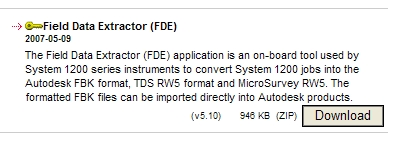
We used the usual, Topcons own pack but it only gave us NEZ of points file. I asked for Topcon’s documentation and THERE (who would expect that) we found a few words about LandXML… After exporting the job from the jigger and importing it back in Civil 3D as Survey LandXML we hit the wall of a syntax error on line 1224…
Somehow this time, the crew was impressed just by the fact that we were able to display points and symbols in the correct layout. We left it at that and continued with the data set by learning about the best ways to define breaklines from selected point objects on the screen. So we made a Point File format to import points by Point Name:
 and we arrived at the points in Prospector and on the screen. As far as everyone was concerned, this mission was accomplished:


But not to me, since that Survey LandXML import went part of the way but just shy of completion, some under the hood work was on the books.
The sample data, screen captures and the outcome was sent to Autodesk. Digested and disected, not sure about the order there, I had the advice of resolution come my way in the form of Service Pack, soon enough.
So now, we were able to watch (online session this time) Topcon generated Survey LandXML file produce some Survey content in the Survey database and it looked like this:
 The outcome is that now surveyors can explore the full potential of setting up multiple stations, defining Traverse loops, collecting figures etc. and significantly cut down the time spent in the office on processing those points to define breaklines, check and correct the data…
Meeting with strangers and then parting with friends a couple of days later is my perfect scenario but this one had to be extended well beyond Friday evening since flights from Coober Pedy resume on Sunday afternoons only. So, I had a choice to get out and about or stay and rust away in my room. Since no Dorothy with an oil can was in sight, I decided to go.
It was all hip-to-hip that Friday night at the Main Pub in Coober Pedy when the travelling hoo-wee-hop of leaping lizzards show passed through the town. I too, was lining up at the bar for some digger’s mouth relief. I thought I was having fun until a local dealer of “fine Opal” from his pocket (that should have bought him a few more drinks that night) made me realize just how obvious I was. It was the time to call it quits and retreat to the confines of the mud hut room and a mellow sound of em-pee-threes streaming behind the barren screen of my mobile phone…